Get regular maritime industry insights!
Join thousands of industry leaders today who have already signed up to receive the latest insights.
sign up


Using drones to speed-up surveys

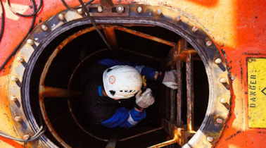
It is an early spring day in Gdansk. On board a dry-docked shuttle tanker two DNV GL surveyors, Leszek Alba and Tomasz Żarski, are climbing down a manhole into an empty ballast water tank to do a drone survey.

It took the DNV GL Gdansk team plenty of practice time and six months of engineering work to get to this point. Flying a drone inside a ship’s cargo hold or cargo tank is tricky. “We had to learn how to configure the settings to make the drone predictable inside a steel compartment,” says Alba.

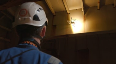
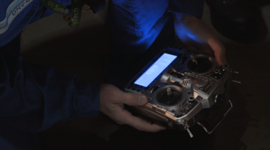
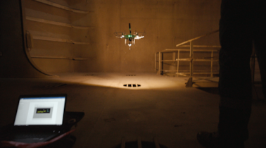
Alba pours contact gel into a reservoir on the drone, then fires up the device while Żarski watches the laptop screen, his hand on the switches of a remote operating panel.

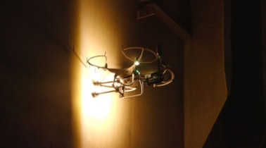
Alba carefully pilots the drone up into the air and against a transverse beam while the gel drips down onto the ultrasonic measurement head.

The moment the device touches the beam, Żarski activates a device which holds the drone in place so the measurement head makes contact with the steel structure. Then he flips another switch to take an ultrasonic reading.

It takes only seconds to reach the next spot and take another measurement. Manoeuvring the drone from one measurement point to the next is precision work that requires utmost concentration.

Each time the laptop screen shows the thickness reading transmitted by the drone. Everything looks fine and within spec.
Join thousands of industry leaders today who have already signed up to receive the latest insights.
sign up